The Canals of Edo
The Captain has pounded the pavement of Ginza over the course of many days and nights - sometimes face-first for the latter. This week the newsman journeys back to the days when the area's shopping streets of today were crisscrossed with canals.
J apan's construction industry is renowned for its proclivity for paving over anything that does not stand still. But in terms of magnitude, today's concrete pourers were certainly rivaled by the work of their predecessors, who cut and filled what is now Ginza into a network of canals and bridges before transforming the area into the asphalt slab it is today.
Runoff from the Tone River, which now forms a border between Chiba and Ibaragi prefectures, contributed to a marsh at the east edge of Edo Castle. With the arrival in 1603 of the Shogunate of Tokugawa Ieyasu (1543-1616), who desired a steady flow of food and building products to arrive at the castle entrance, the areas to the south (today's Ginza and Tsukiji) and further towards the Sumida River had to be developed. Along with establishing a series of wells and rerouting the Kanda River to flow through Edo instead of terminating in the Tama River, Ieyasu constructed a canal (the Dosan-bori) to link the doors of the castle to Nihonbashi, which was the location of the original Tokyo fish market.
 A further network of waterways was constructed throughout the Edo Period (1603-1867). Transport by choki-bune (a small wood craft propelled by a pole pushing off a waterway's bottom) then became the common means of getting from point to point, with bridges assisting in street transport. Today these bridges form the names of many intersections throughout Ginza.
Ginza is one of the few areas within the twisting streets of Tokyo which can be said to be laid out on a grid. Aerial photos of the area taken from a balloon one century ago are on display on the first floor of the Shiodome Media Tower in Shiodome. The images show how the roads, bridges, and canals then in existence intermingled. Showa-dori, which runs parallel to Chuo-dori to the south, didn't exist. In its place are single- and double-story shacks. The Hattori (now Wako) clock tower at the 4-chome intersection, Hibiya Park, and the Kabukiza theater are the most easily recognizable landmarks.
 One photo in the exhibit shows the confluence of the Sanjukken-bori canal at Shimbashi with the Shiodome River, whose upstream reaches extended towards Toranomon. Few Ginza shoppers strolling between Mitsukoshi department store toward Tsukiji today will notice the vertical hump and lateral bulge in both sides Harumi-dori halfway to the Kabukiza. That raised pavement, which is now the home of an underground arcade housing three movie theaters, the adult goods store Aladdin, and a few greasy restaurants, was where the Mihara-bashi bridge spanned over the Sanjukken-bori at its midpoint.
Between 1948 and 1953, Sanjukken-bori was covered in concrete. Today its grounds are occupied by a quiet street of convenience stores, offices, and art spaces. One of the few reminders remaining is a small plaque posted next to a public toilet, frequented by taxi drivers, at the east end of the Ginza Nine shopping center.
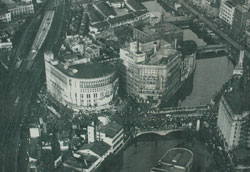
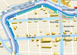
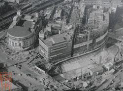
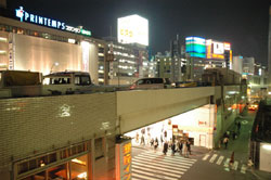
 Perhaps the grandest stretch of waterway was the Soto-bori, which gently curved from what is today the Sukiyabashi intersection, fronted by the Sony Building, on northward past the Printemps shopping complex to JR Yurakucho Station. Photos of the canal from as early as 1927 can be seen, though encrusted with smudges of black soot, along a concrete railing just outside the south exit of Yurakucho Station. A photo from 1928 shows a small boat working its way beneath the concrete bridge. Two men in sailor uniforms, likely part of the Occupation, can be seen crossing from one side to the other two decades later. The curved Nichigeki Theater, the site of nationalist rallies in the early '40s, is visible at the water's edge in 1953. By 1961, the area is shown in its presently developed state, with the aboveground Tokyo Expressway freeway handling traffic nearby.

